Rancho Gaspareño – Oceanfront Development


Rancho Gaspareño – Oceanfront Development
Description
White Sand Jewel on the Baja Peninsula
RANCHO GASPAREÑO
Welcome to Rancho Gaspareño; where passion becomes inspiration. This is an amazing oceanfront development opportunity perfectly situated between Cabo San Lucas & Todos Santos.
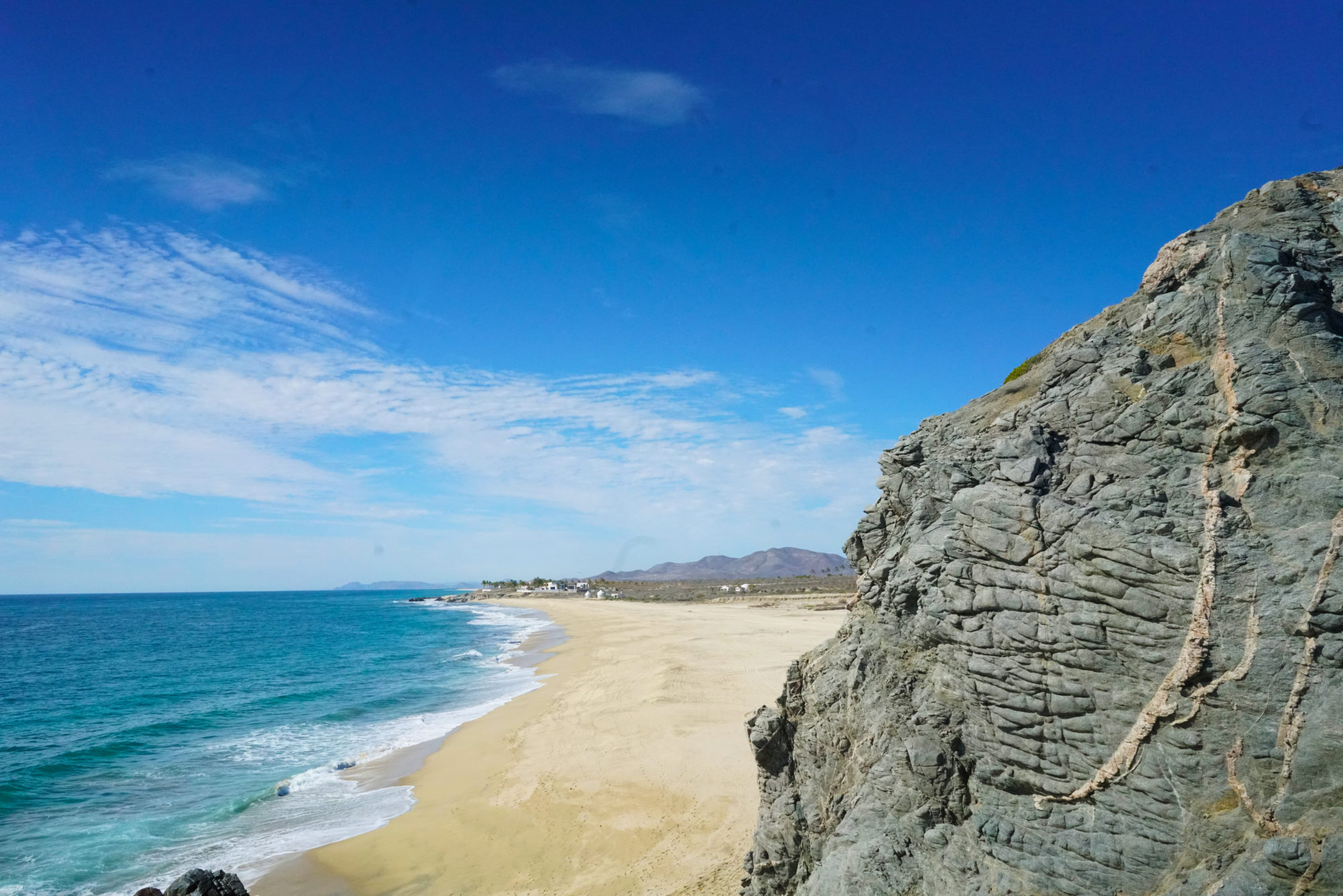
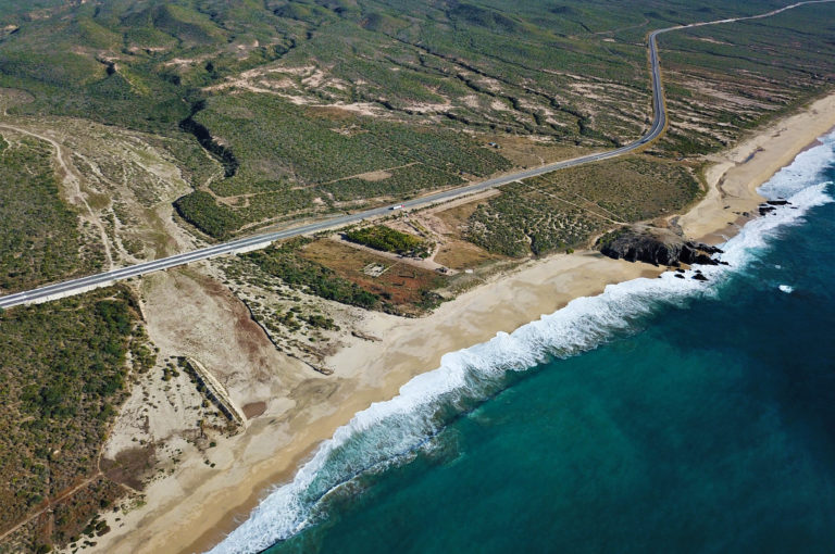
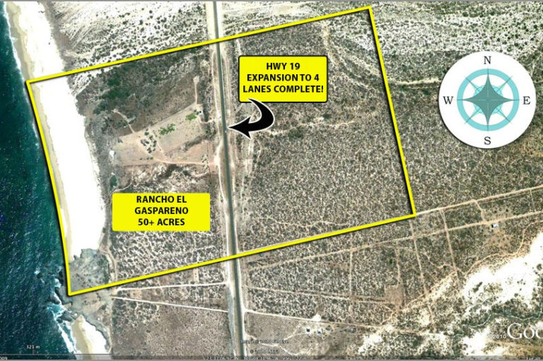
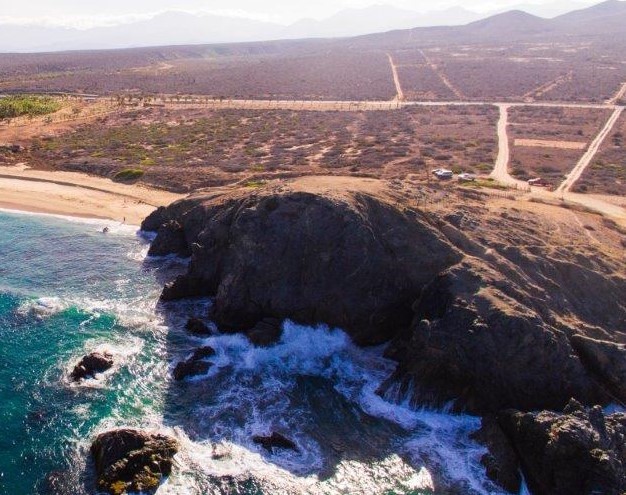
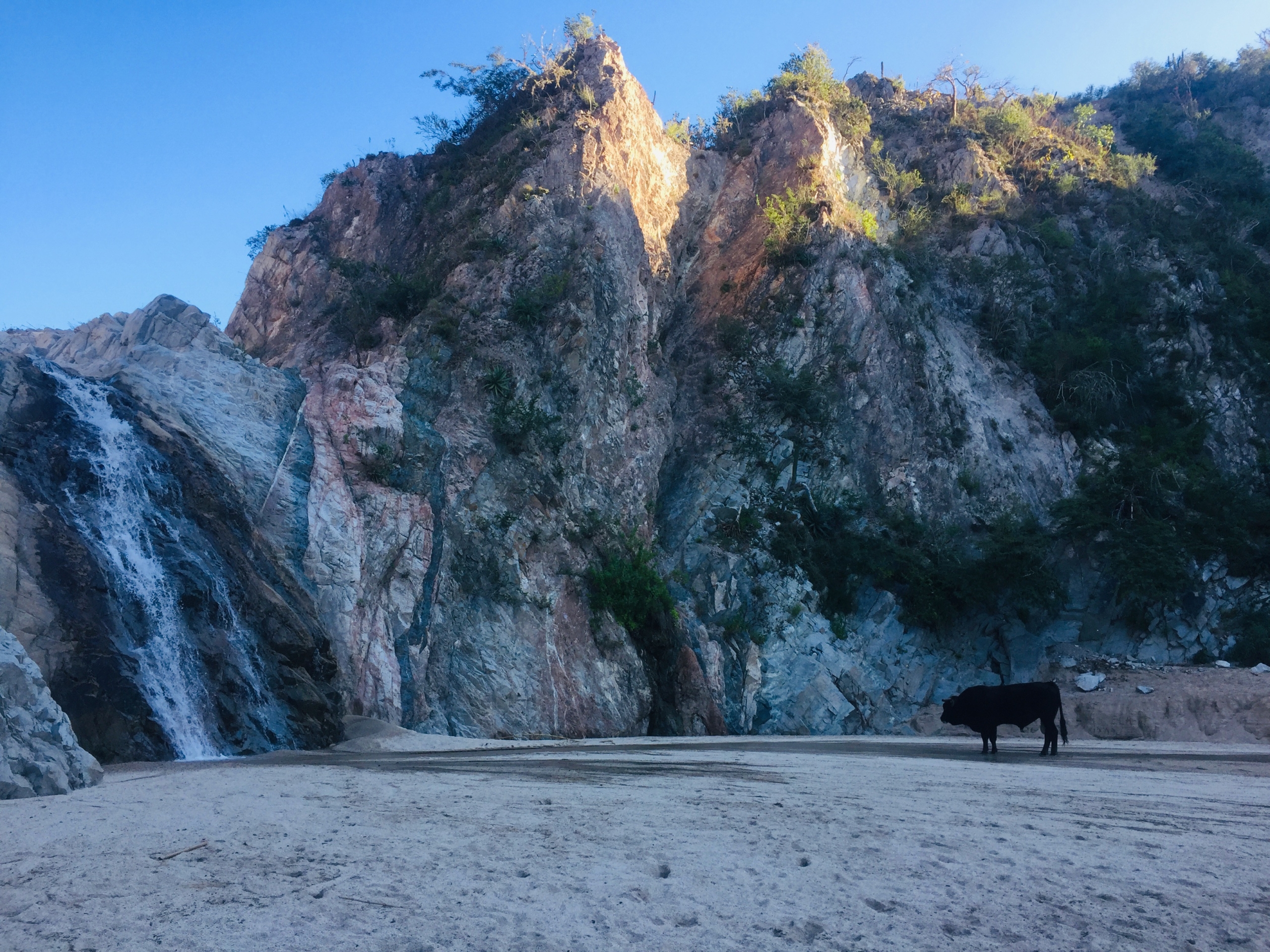
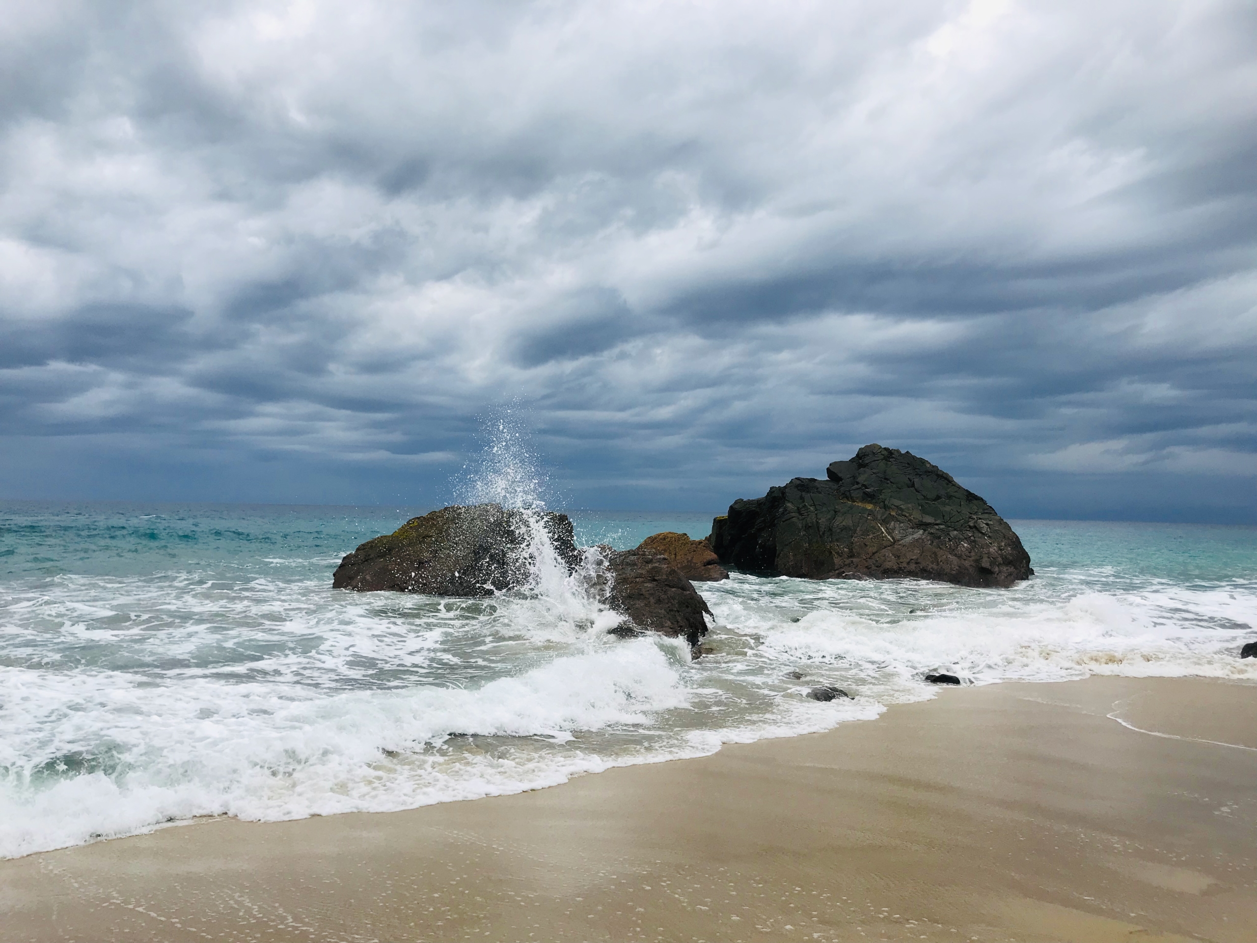
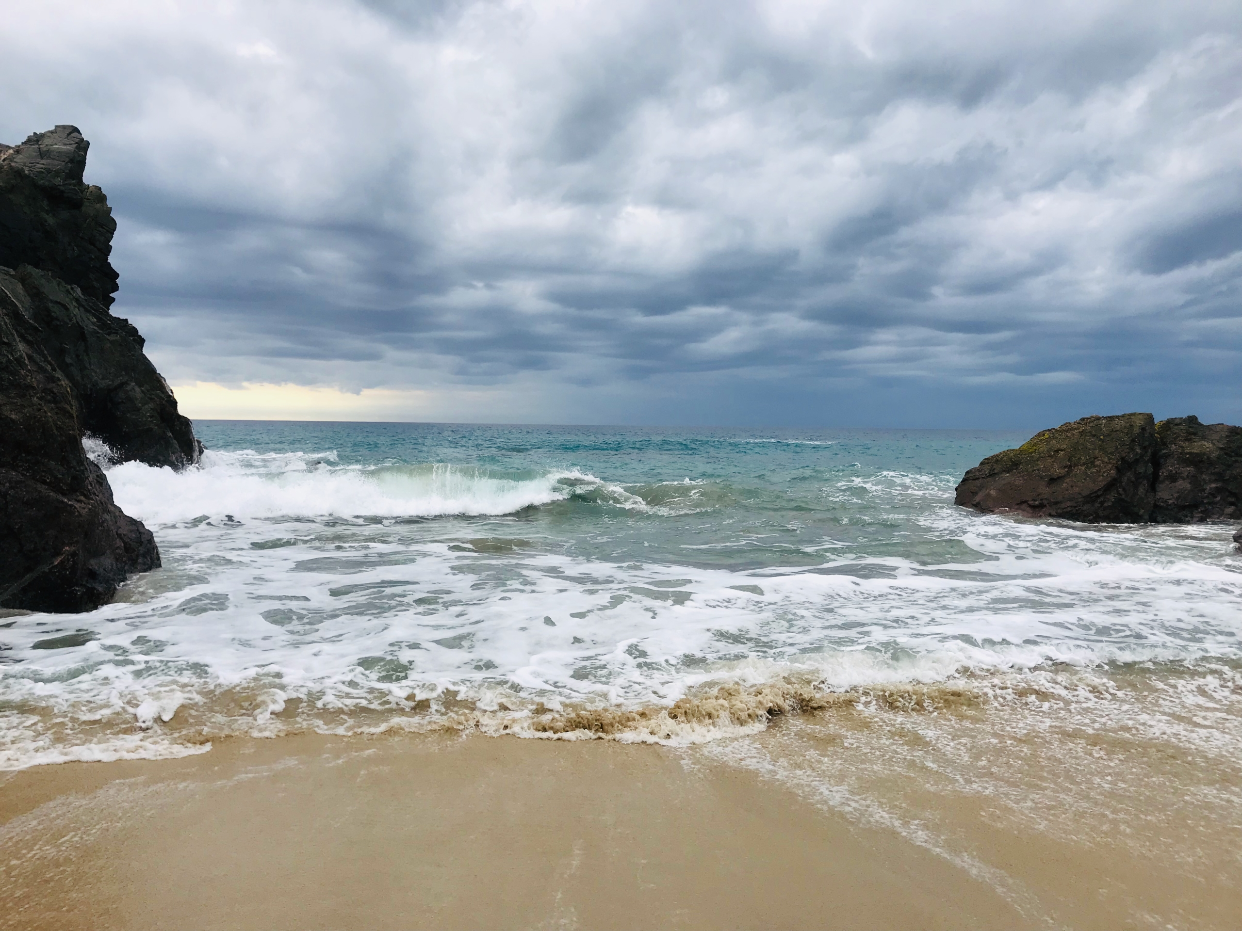
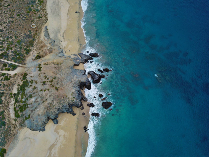
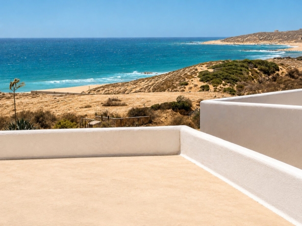
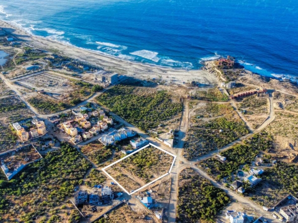
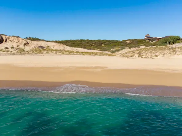
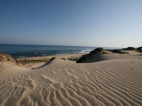
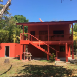
42 acres of gently sloping land on the Pacific Coast of Mexico. The property features an amazing monumental headland which is perfect for an amazing boutique hotel, restaurant, and tequila/wine tasting room.
DESCRIPTION OF OFFERING: Owner to make this property available for development to qualified and experienced investors and/or investment groups in an outright sale or through a joint venture.
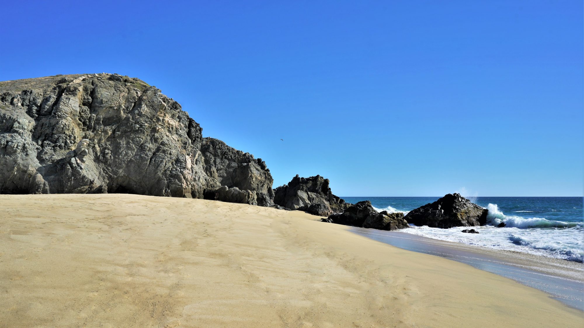
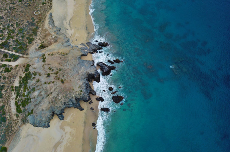
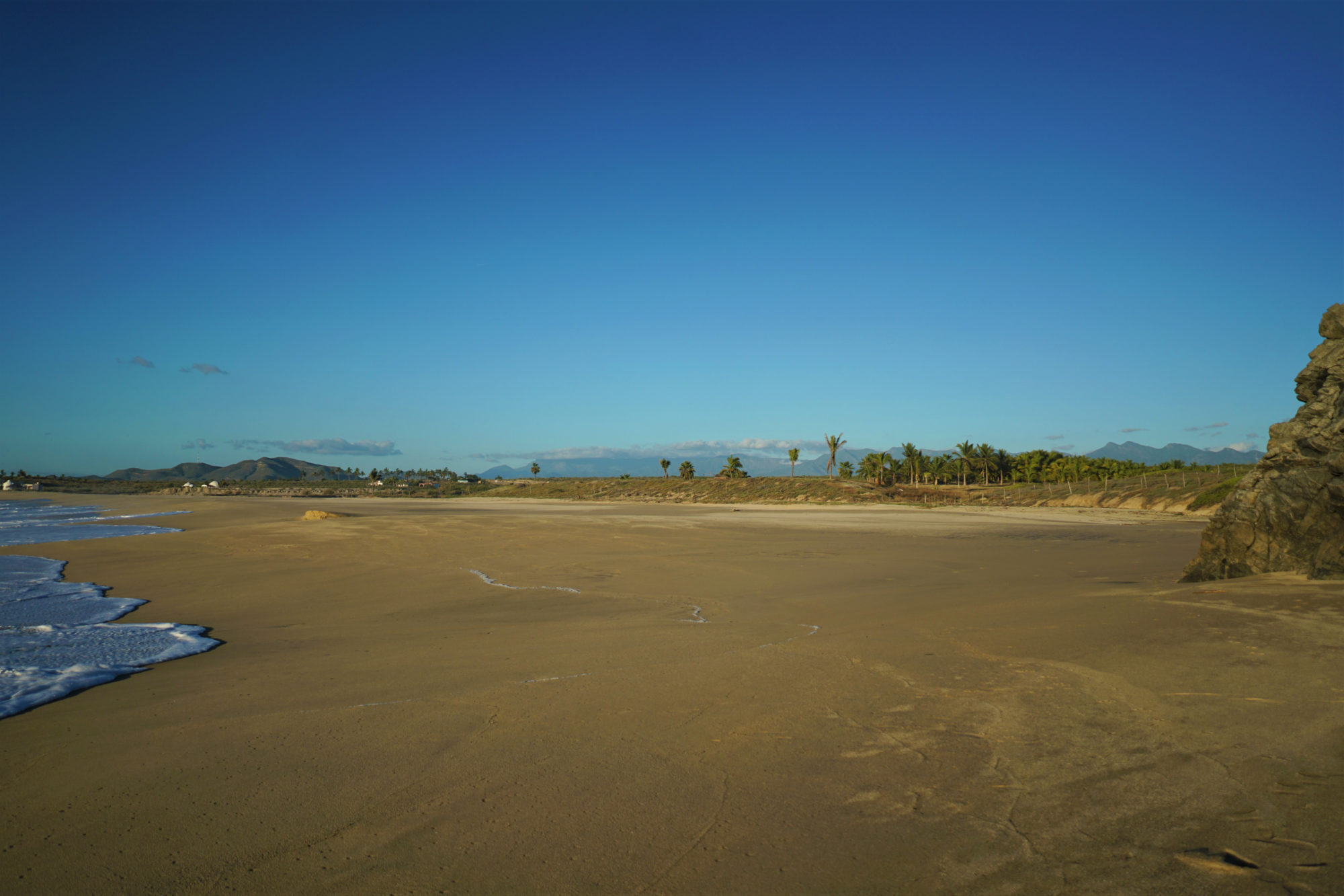
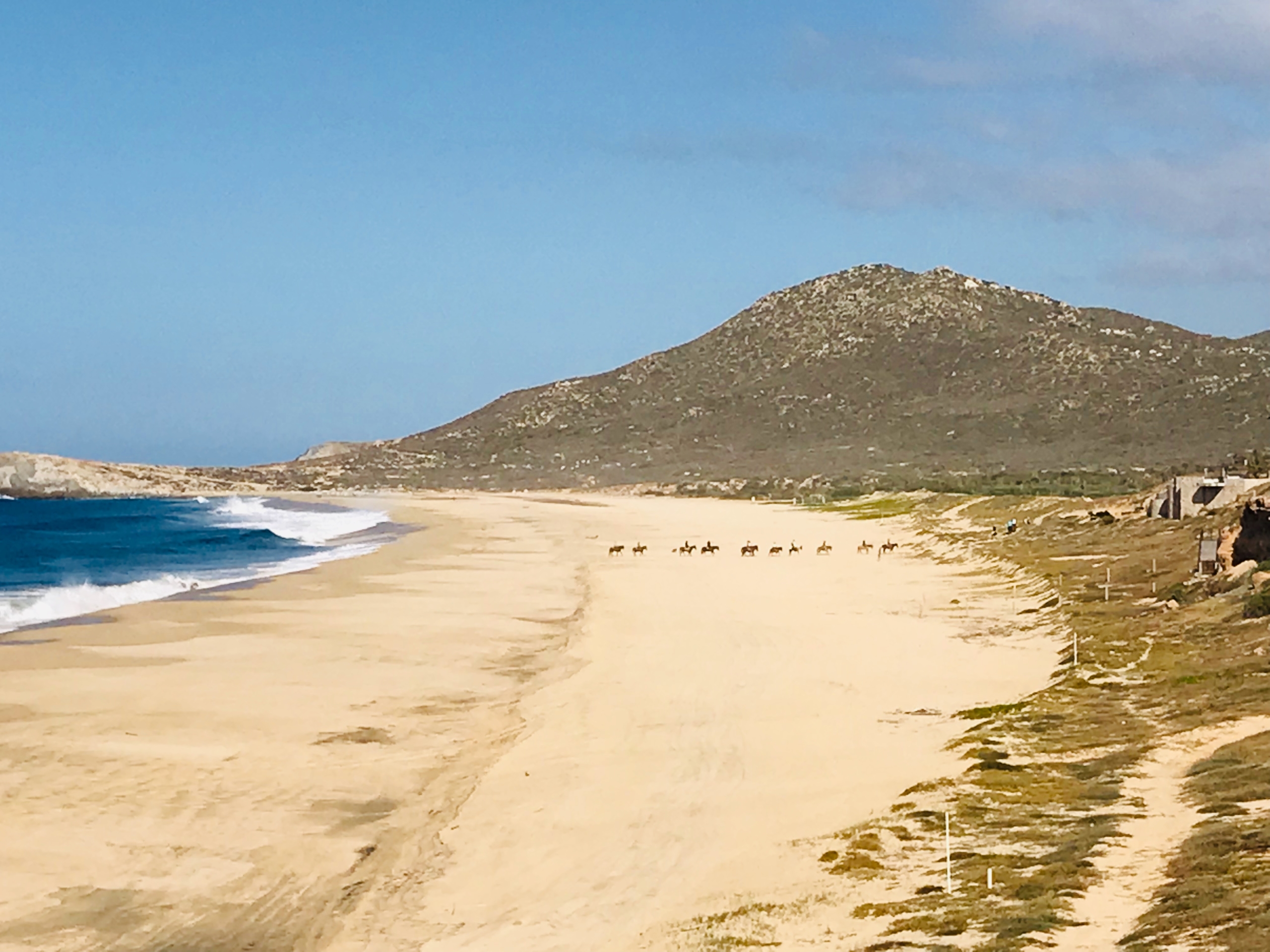
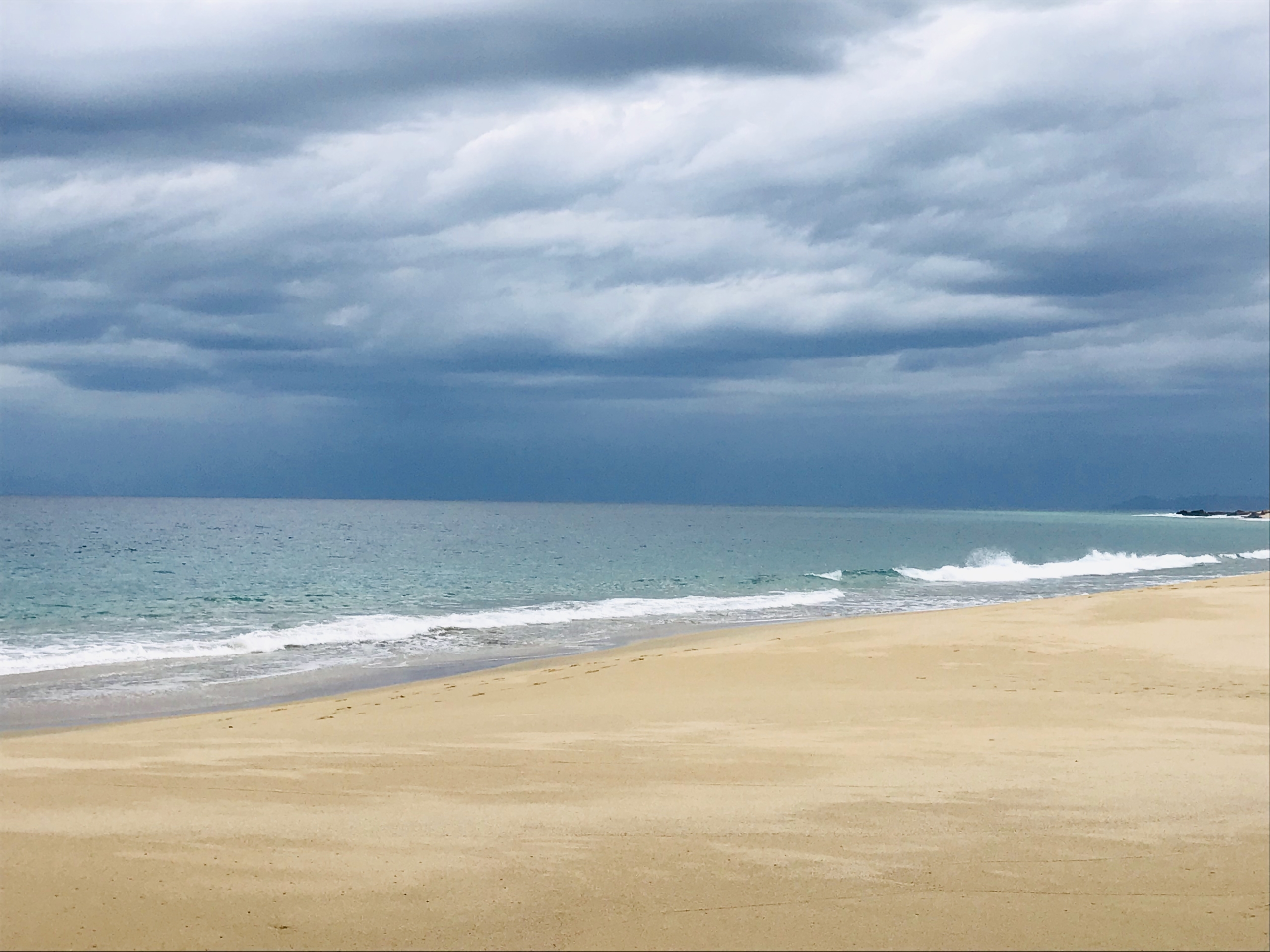
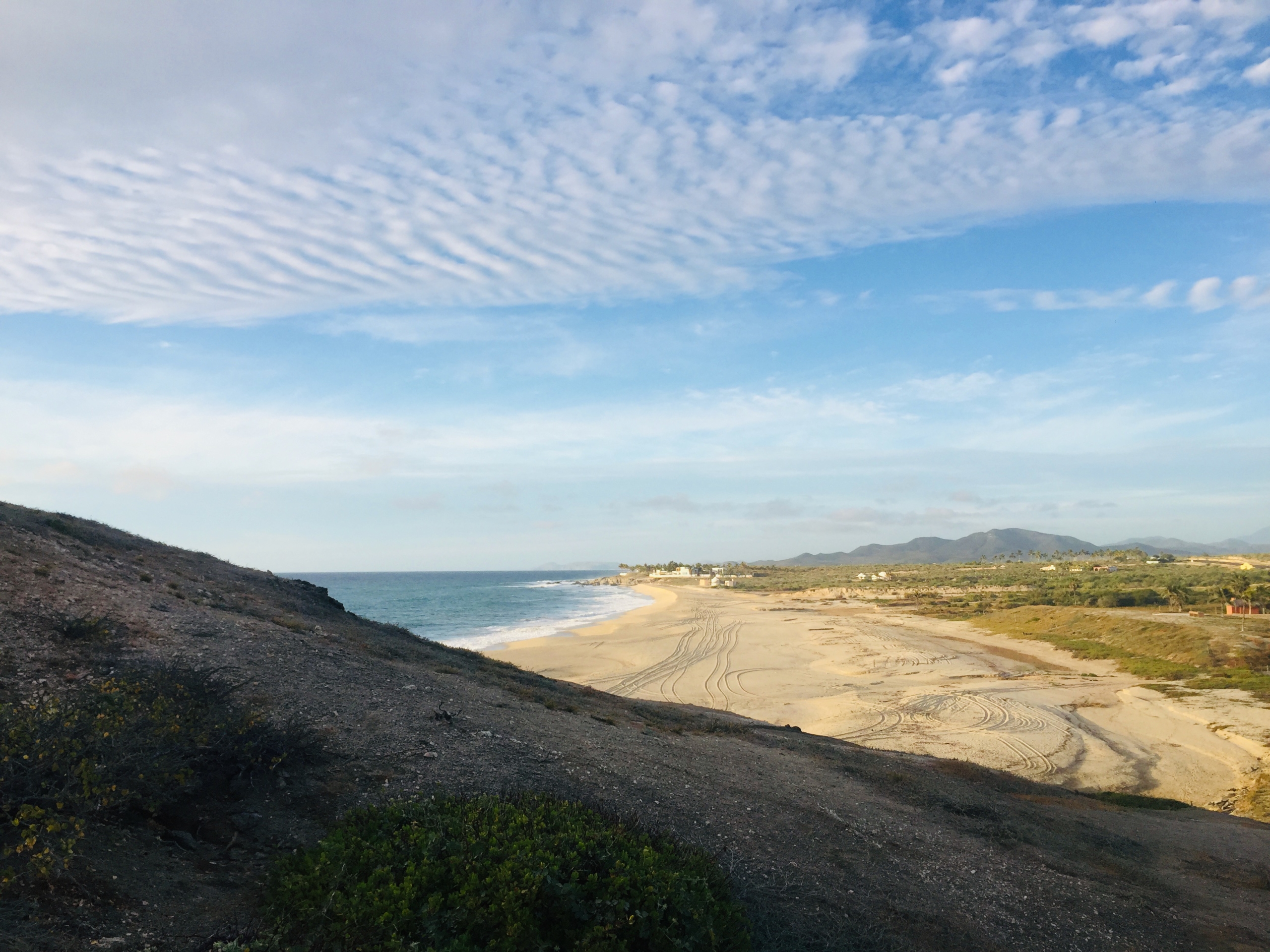
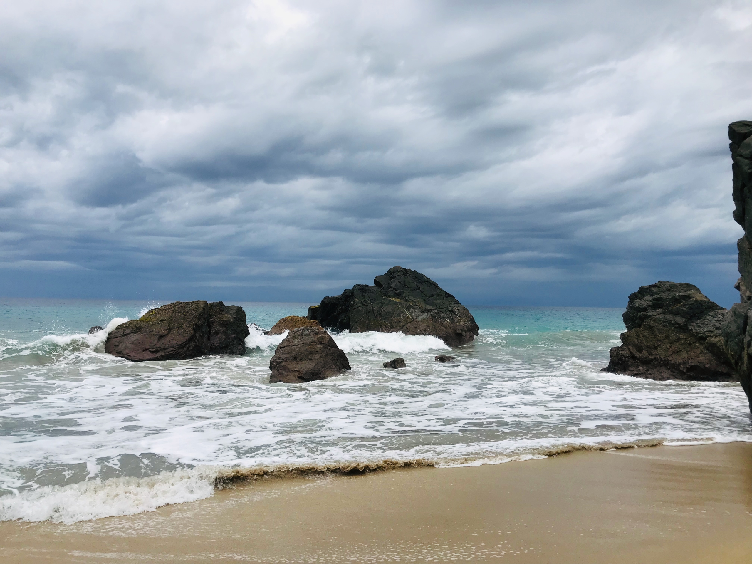
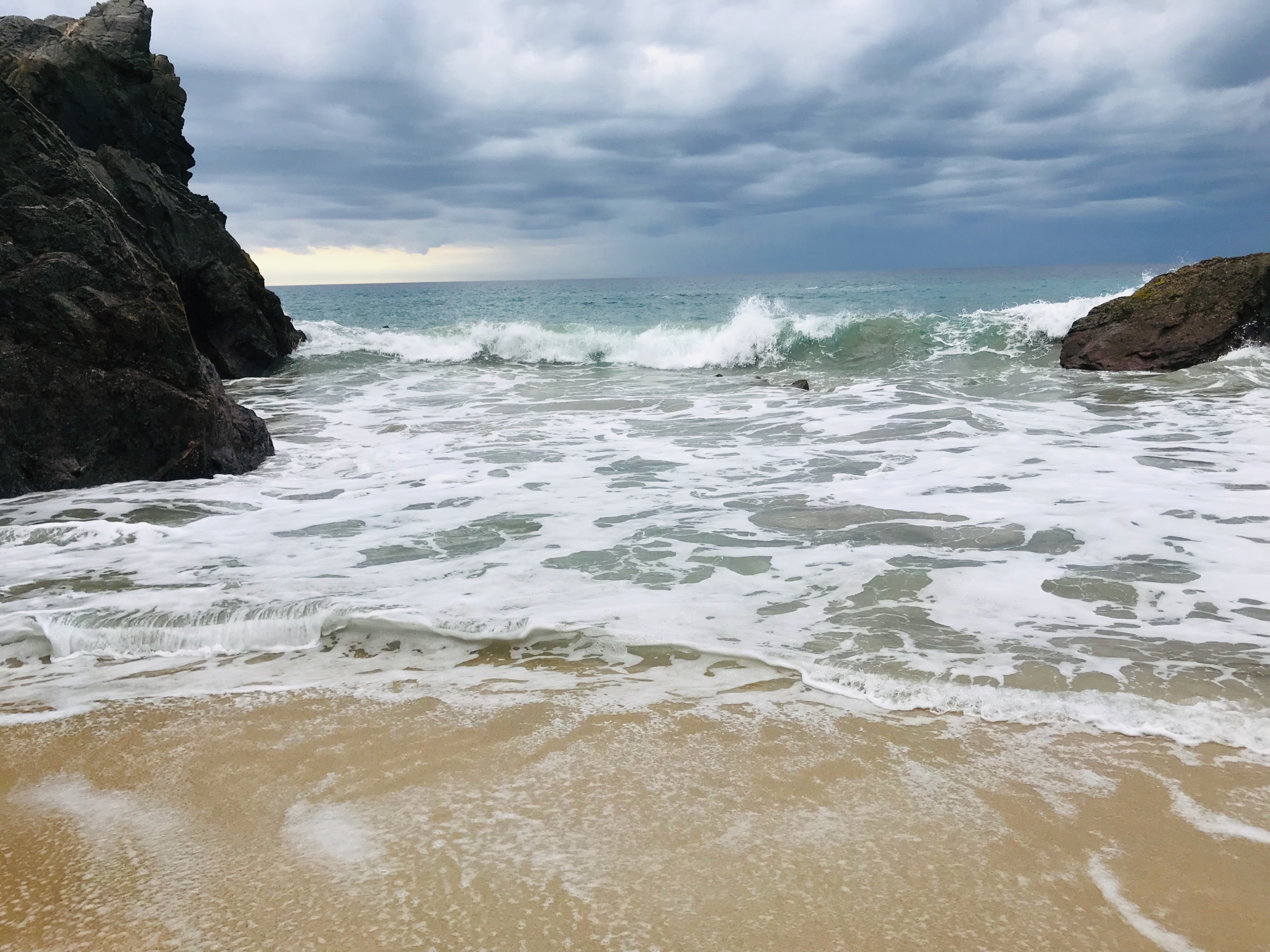
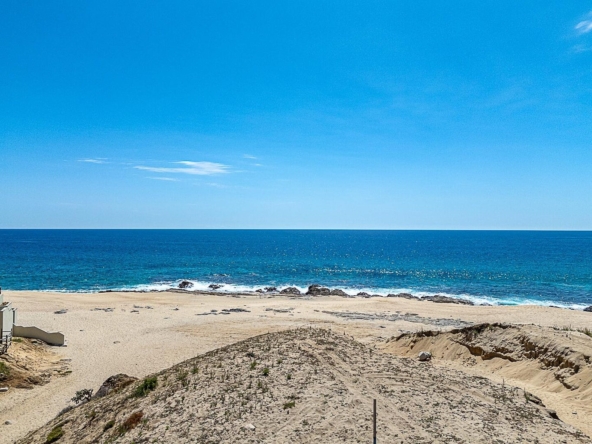
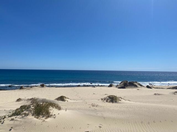
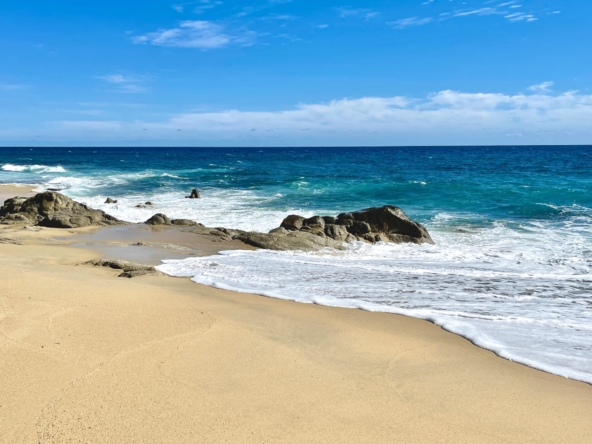
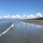
Approximately 414 meters (1,242 lineal feet) of rocky point and gentle beach comprise the water frontage. The federal four-lane highway 19, runs through the property creating three distinct development areas; a knoll above the rocky point for a boutique hotel and restaurants; gentle sloping land from the beach to highway ideal for shopping village or other commercial venture; and approximately twenty-four acres across the highway with sloping water and mountain views, ideal for residential or retirement village and possible small emergency clinic.
With the East Cape blowing up with major hotel construction this area still offers an escape from the hustle-bustle of Cabo San Lucas and will end up being a major tourist draw as it is just minutes away from both Cabo San Lucas and the magical artsy village of Todos Santos which is already a tourist favorite. This is a gem of an opportunity. Seller willing to sell outright or Joint Venture.
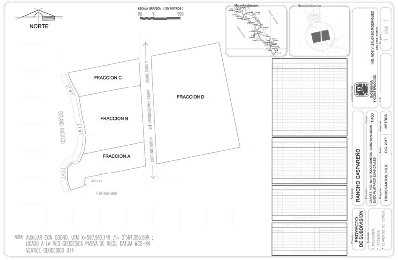
PARCEL DESCRIPTIONS:
Rancho Gaspareno – Oceanfront Development Land Between Cabo & Todos Santos
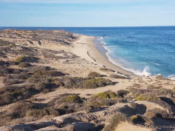
PARCEL A has a total of 27,015 square meters, (approximately 6.6 acres) with over 600 linear feet of water frontage. This is the crown jewel with a gigantic rock promontory that soars 100 feet above the sea. Views are tremendous and extend for miles in each direction. The highest and best use of this portion is a small hotel, restaurants and other lodgings with good highway access and ample space for parking.
PARCEL B. consists of 48,191.74 square meters (approximately 11 acres) with 640 lineal feet of fine sandy beach. This portion can be ideal for bungalows and commercial with over 600 feet of highway frontage. Activities for the entire family can be included here, including tennis, pitch and putt golf, swimming, water slide, wine /tequila tasting and also an emergency clinic for Todos Santos-Pescadero folks.
PARCEL C is approximately 4 acres, 120 feet of oceanfront and sandy beach frontage plus or minus 20,000 sq. meters.
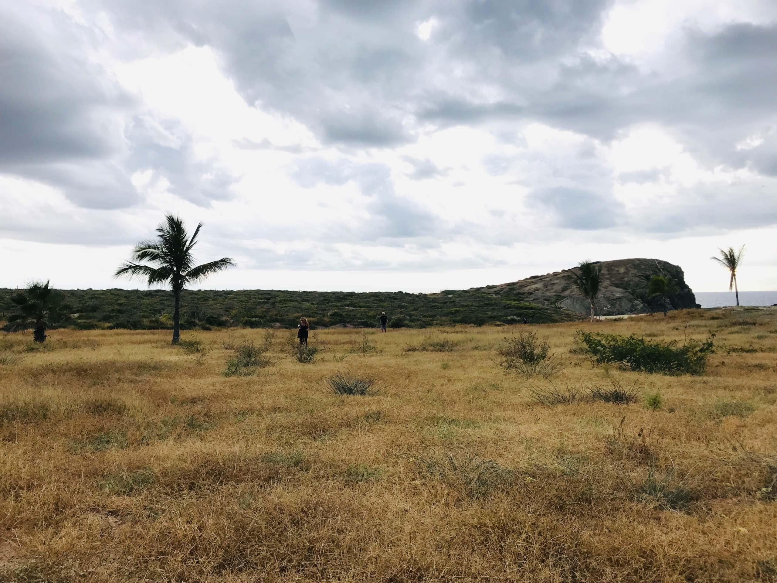
PARCEL D, overlooking the sea, has 115,944 square meters (approximately 24 acres) with about 1200 feet fronting the four-lane Federal Highway 19. The gentle slope on this portion allows for panoramic views of the sea to the southwest and the mountains to the northeast. It is ideal for high-density development as an aging-in-place community with full services.
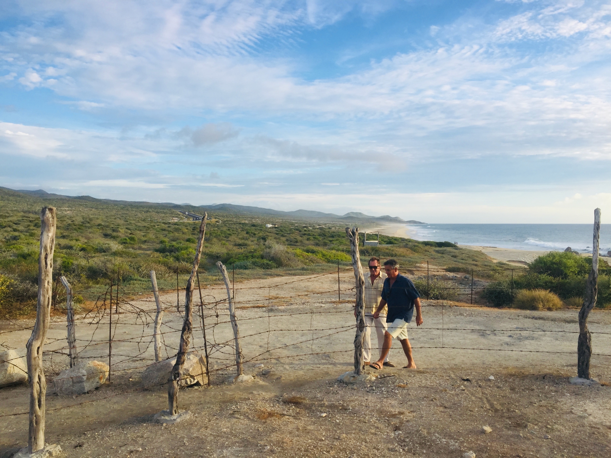
HIGHWAY and RETURN ACCESS: A bridge and arroyo on the Northern side of the property provide an ideal pass-through and safe turn around for the highway. Developer to permit access for this project. There is outstanding highway access and more than one-half mile of frontage total on the upper and lower properties
ELECTRICITY: Available and lines can be run from Cerritos Beach, 9.6 miles away.
WATER: One well exists on the property and concessions are pending for agricultural usage. A desalinization plant will be required by state authorities for commercial and residential development. High technology is readily available.
SOLAR ENERGY; With more than 360 days of sunshine per annum, Baja California Sur boasts more solar sophistication than anywhere outside Israel. Most of the properties in the vicinity and on the same latitude on the Sea of Cortez boast of being “off the grid” with advanced solar technology available. Excess energy produced by the installed systems can be sold to the electric company.
INTERNET, CELL COMMUNICATIONS: The Baja Peninsula in this area enjoys outstanding internet and cellular communications.
TITLES: Property is free and clear of liens and encumbrances. Titles in the name of a Mexican corporation and one portion in a bank trust (fideicomiso). The property has been held under one ownership for more than thirty years.
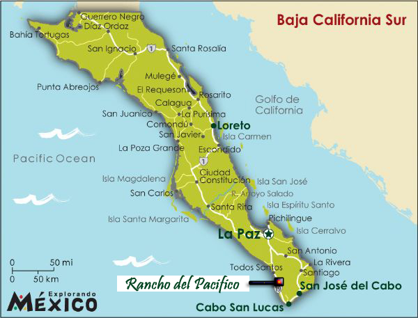
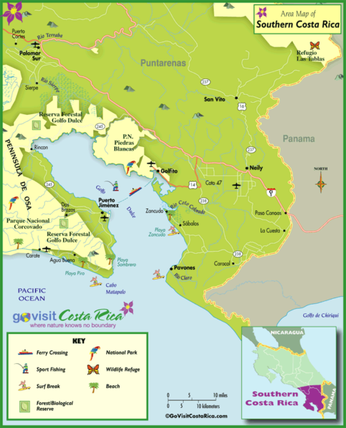
LOCATION: Approximately halfway between the Magical Town of Todos Santos, picturesque, art colony, cultural village and the fabled Cabo San Lucas. This property is ideally located as a stopping point and day trip from either town and from La Paz, the historic capital of the state. The Sierra de la Laguna, the highest point in the area provides outstanding hiking and nature activities. Gaspareño Point, an underwater canyon offshore attracts migrating grey whales due to the plankton in the water. Incredible sea activity and views during the migration season.
Additional Resources –
10 Reasons Foreigners Should Consider Forming a Mexican Corporation
Best Beaches of the Pacific Corridor of Baja Sur
Neighborhood
__________________________________________
Historical Overview of Baja California

The area is rich with unique folklore. There is a confirmed history of “Amazon” Indian civilization, pirate plunder and treasure, Damiana-the ancient sex enhancer growing wild on the Rancho and more.
1804: The Spanish colony of California is divided into Alta (“upper”) and Baja (“lower”) California at the line separating the Franciscan missions in the north from the Dominican missions in the south.
In 1850, after Alta California is annexed by the United States, Baja California is further divided into northern and southern territories.
1952: Northern Baja California becomes the 29th state of Mexico. The southern portion, below 28°N, remains a federally administered territory.
1974: The southern territory becomes the 31st state, Baja California Sur.
1989: Ernesto Ruffo Appel of the PAN becomes the first non-PRI governor of Baja California and the first opposition governor of any state since the Revolution.
Guaycuras Indians
The Guaycuras Indians were native to the Southern Baja area and as legend has it, the men were used for procreation and the tribe was run by their ‘Amazon Queens’, the most famous one being Queen Calafia. Some schools of thought have it that California was named after her. She was quite famous as evidenced by the use of her name “Calafia” throughout Baja and Mainland Mexico.
The Guaycuras Indians were tall, over 6′ tall and looked like no other Indian in any part of Baja or mainland Mexico. There is no record of any Indian anywhere in the western hemisphere that has any likeliness to them. Due to their resemblances to the seafaring voyagers of the Pacific Islanders, and the similar latitude to the Hawaiian Islands, there is more than a possibility that they were direct descendants of Polynesian seafarers attempting to find the Hawaiian Islands that had blown off course and landed at southern Baja California and settling there. You will notice as you observe the local people of the area, you will see a number of tall slender dark-haired Indians; these are descendants of the original Guaycuras.
By 1767, virtually all the Guaycuras Indians in the area had died either of European diseases or in skirmishes with the Spanish. Surviving mission Indians were moved to missions farther north, but San Jose del Cabo just 30 minutes south, remained an important Spanish military outpost until the mid-19th century when the presidio was turned over to Mexican nationals.
English Pirates on the Sea of Cortez
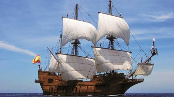
Sir Francis Drake, Thomas Cavendish, William Dampier, Woodes Rogers, Thomas Dover, Cromwell and other English privateers left behind a colorful Baja legacy. In spite of Spain’s repeated attempts to colonize the peninsula, throughout the Spanish colonial period the pirates probably gained more wealth in the Californias than the Spanish themselves. For 250 years they plagued the Manila galleons off the coast of the Californias, finding the bays and lagoons of Baja’s Cape Region perfect hiding places from which to launch attacks on treasure-laden ships.
In La Paz, their knowledge of the strong breeze that blows into the harbor every summer afternoon assisted the pirates in attacking Spanish galleons while the vessels were effectively trapped in the bay. Four centuries after the first Manila-Acapulco voyages, this afternoon wind is still known as El Coromuel, named for the Puritan Cromwell’s, father and son, who ruled successively as Lord Protectors of England or Cromwell the Pirate.
The Disappearance of the Ship, Desire
The most notorious of the Pacific privateers was Sir Thomas Cavendish, whose greatest feat of plunder occurred at Cabo San Lucas in 1587. There his two English vessels, Desire and Content, commandeered the Spanish galleon, Santa Ana, following a protracted sea battle. Cavendish set fire to the Santa Ana after looting its cargo holds and setting its crew and passengers ashore. The Spanish crew later retrieved the burned hulk and restored it for a return to Acapulco.
The plundered treasure, meanwhile, was divided between the Desire and Content. The ships set sail for England immediately, but during the first night of their triumphant voyage, the Desire disappeared. Cavendish reported in England that the captain and crew of the Desire must have scuttled the ship on a nearby island and disappeared with the loot. Neither the wreckage of the vessel nor the treasure was ever discovered; some historians speculate that at least part of the missing wealth remains buried near the Cape.
A Visit by Robinson Crusoe
In 1709, famed corsair, Woodes Rogers, landed in La Paz after rescuing a seaman who’d been marooned five years on a deserted island off Chile’s coast. The rescued man was Alexander Selkirk, whose island sojourn became the inspiration for Daniel Defoe’s, Robinson Crusoe, published in 1719. Selkirk was aboard Roger’s Dover when the crew captured the Spanish galleon, Encarnacion, off Cabo San Lucas in 1709; he served as sailing master on the ship’s return voyage to England the following year.
Legends of Buried Treasure at Rancho Gaspareno
It is well-documented history that notorious pirates roamed, sailed, and plundered in the cape area for almost 300 years. During these periods pirates were mainly of Dutch, Spanish, English, Chilean origin. In the periods from the mid-1500s to the 1800s over 250 Spanish Galleons loaded with their super cargos of various valuables from the Philippines (named Manila Galleons), passed through and stopped in the cape areas to prepare for their trips to Acapulco, the headquarters for New Spain and then on to Spain. Many tales of fighting and plundering are well documented in history. As recent as 1974 while building the road to Pichelinque, the out-of-town road to the ferry terminal near la Paz, a pirate chest of plundered loot was discovered by road workers.
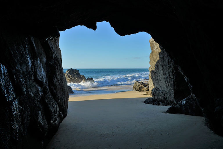
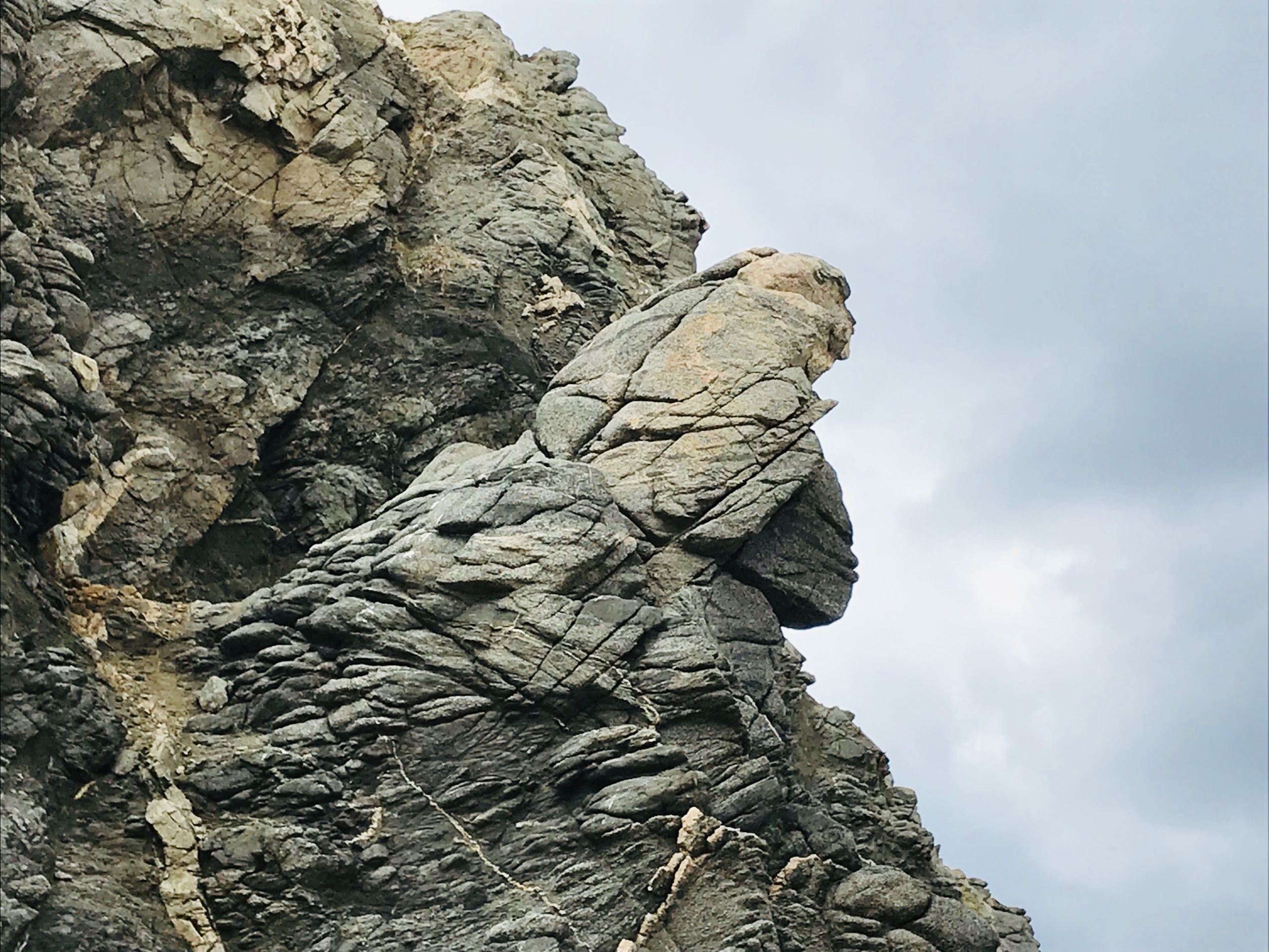
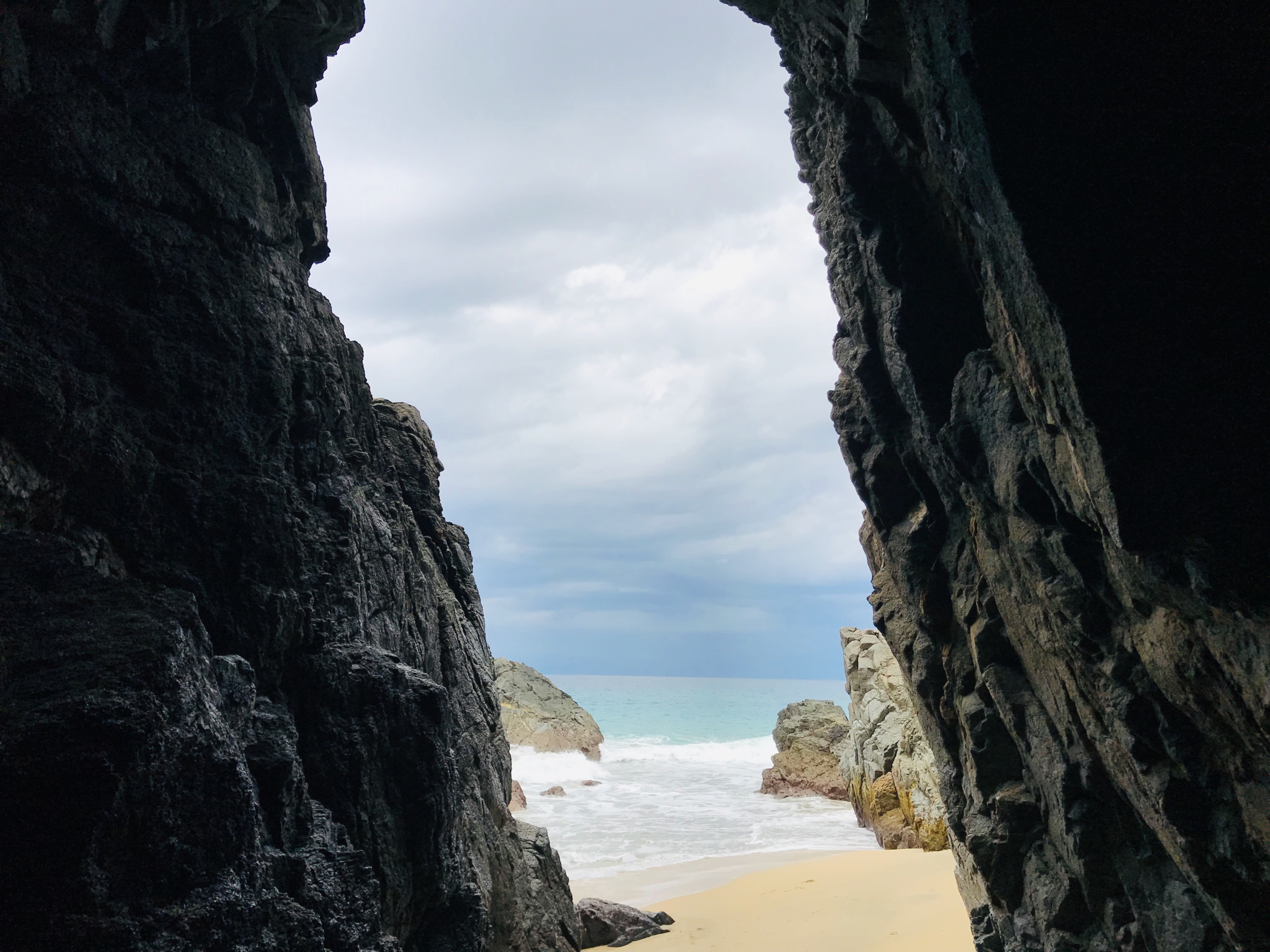
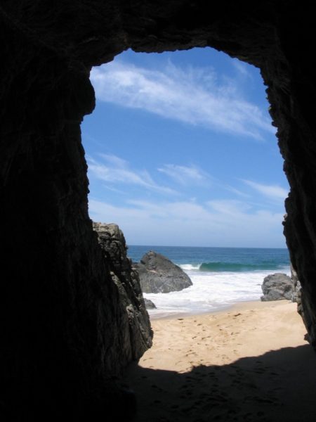
Cave featured in Local School Outings
Many local school trips bring classes to the cave pictured to the right and tell the well-known stories of long ago.
Located inside the rock promontory on the southwest corner of the Rancho Gaspareno property is a cave that can be accessed from the beach at low tides. It has at times a very high ceiling.
Legend has it there is pirate’s treasure buried somewhere in the cave, and with the history and confirmation of pirates in the area, this just could be true. The cave goes back approximately 100 feet into the rock, with sand coming in and out with the different tides, the height of the cave can vary drastically depending on the time of the year.
Details
Updated on September 15, 2021 at 12:04 am- Property ID: ISP-7298
- Price: $12,000,000
- Land Area: 50 m²
- Property Type: Lots & Land
- Property Status: For Sale
